
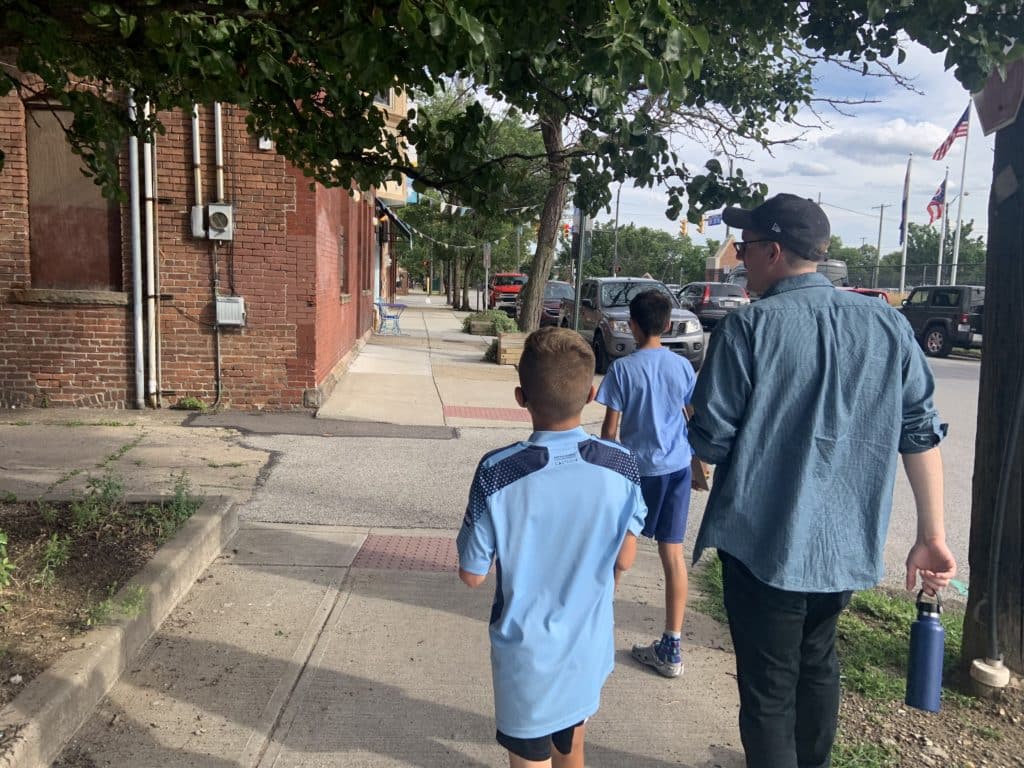
If you live, or commute though Ohio City, you have likely seen the yard signs scattered around town asking passersby to share their experiences walking, driving, and cycling around the neighborhood.
Ohio City Incorporated (OCI), the neighborhood community development corporation for the neighborhood, launched its “Ohio City Mobility Study” in summer 2022 in conjunction with 3MPH Planning, a local consulting firm that specializes in pedestrian safety. The project was inspired by reduced vehicle traffic and increased foot and bike traffic in the neighborhood, a trend that began during the pandemic and has continued, said Nate Lull, community planning manager at OCI. In keeping with the city’s Vision Zero initiative, planners are particularly focused on improving pedestrian safety.
Together, OCI and 3MPH are conducting a two-part project that is gathering information to identify, then address, commuting challenges in order to improve safety and quality of life in the neighborhood. Instead of costly structural changes, the project aims to implement low-construction, low-cost interventions with the possibility of more permanent changes after these are implemented and studied. When part one of the project – the study phase – recently completed, nine locations were identified for improvement:
- Crossing W. 25th St. at Market Square
- Lorain Ave. at Abbey/Gehring
- Crossing Chatham Ave. and Fulton Road
- W. 41st St. corridor
- W. 44th St. and its intersection with Bridge Ave.
- W. 29th St. where it meets Detroit Ave.
- Intersection of W. 45th Street and Lorain Ave.
- Crossing W. 25th St. and Detroit Ave.
- W. 28th St. underneath the Shoreway
Collecting community input online, on the phone, and on the street
During the first phase of the study in summer 2022, the organizers focused on collecting input from the community to get a grassroots understanding of locations where people face problems getting around the neighborhood.
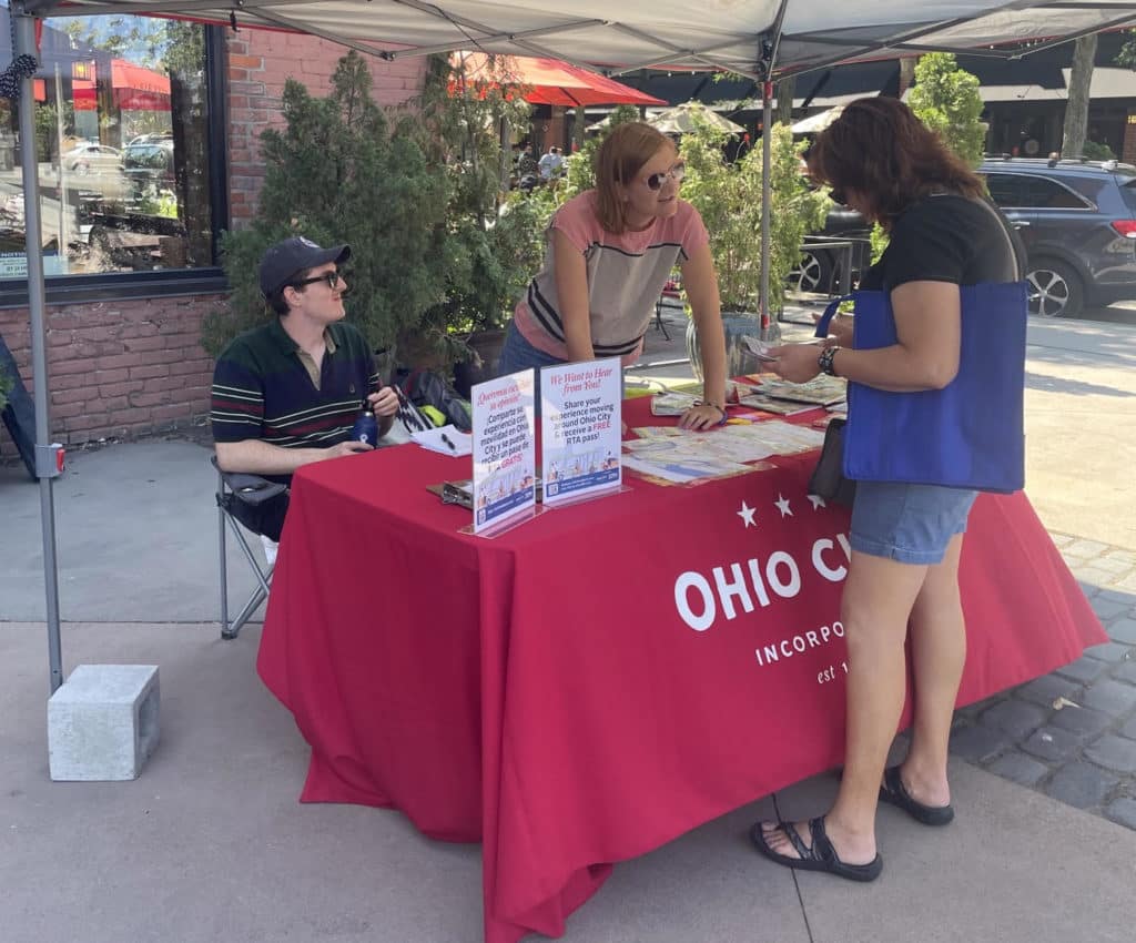
To collect the feedback, OCI hosted a website for the Mobility Study to collect information around the clock, and also met residents where they were in daily life.
On the ground, residents were able to give feedback to study representatives who canvassed near RTA hubs around Market Square, stopped passersby, attended block club meetings, met CHMA residents, and shared information about the study at OCI’s monthly community meetings. The team did neighborhood walks with clients of the West Side Catholic Center, with a group of local high schoolers, and with families from Near West Recreation.
Compared to a traditional method of obtaining feedback where officials hold only one or two public meetings, Schmitt says that by melding a traditional format and grassroots method, they were able to engage about 300 individuals in person. “It was a thorough public engagement project compared to a traditional public engagement,” said Schmitt. “We wanted to get a representative cross section of the neighborhood. We wanted to include folks who otherwise might not have participated in a traditional process.”
OCI also took phone calls, text messages, and emails from residents who could not contribute feedback physically. On the website, users could complete a survey, mark a map of the neighborhood to address specific locations, and get updates on the project’s status.
In addition to collecting resident feedback, 3MPH also performed a crash analysis using data from the Ohio Department of Transportation (ODOT). Referencing the crash analysis and map of recorded traffic incidents and injuries, Schmitt noted that there is a lot of overlap between observations and official records about where safety problems are. “That’s why we’ve relied a lot on public input,” said Schmitt. “People really know their neighborhoods well, and they’re the experts on their own neighborhoods.”

Reporting back to the community: Nine problem areas
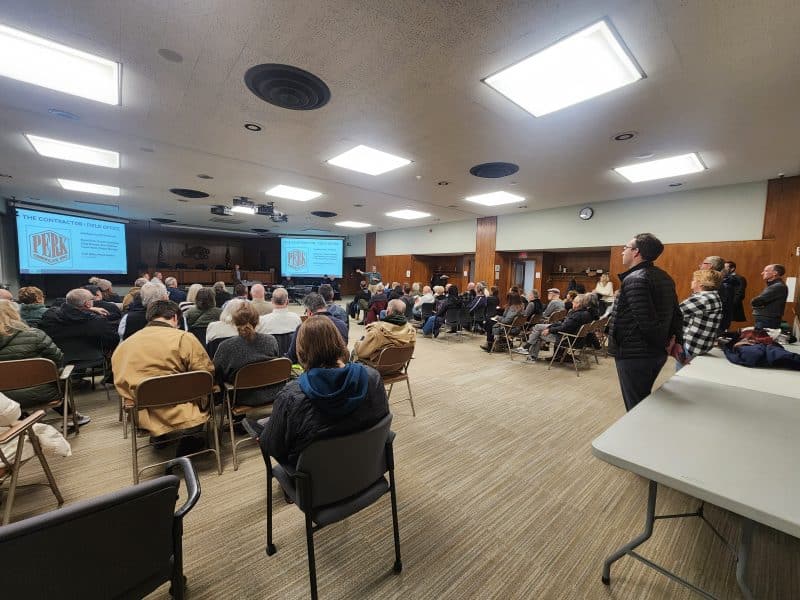
Once all the observations and other data were collected and organized, the study’s team then put together a report which was released on November 15. “The general feedback is that while Ohio City is walkable, we can improve it (mobility),” said Lull. “By improving that, we can make life better in meaningful ways for everyone here.”
At OCI’s monthly community meeting in November, Schmitt and Lull presented their findings and recommendations to the public. As the planners anticipated, the study revealed an overlap between resident complaints and documented traffic incidents across the near west neighborhood.
Using both sets of data, the researchers identified nine problem areas to address. The study was designed to identify smaller-scale problems and to inform smaller-scale solutions, said Schmitt, which meant that the team used the study to magnify neighborhood spots that may be overlooked by big-budget projects. For this project, the team also eliminated junctions already slated for redevelopment, those under state jurisdiction, and high-cost interventions. For example, participants identified crosswalks whose curbs could not be traversed with an accessibility device. Correction would be costly and would require permanent structural changes to the environment, so this problem will not be addressed in the current small-scale project.
These nine selected sites share several common environmental problems: low visibility due to street design and/or parked cars; parking density; negligent driving; and poor sign/traffic light signaling. Some also have histories of inury or loss of life due to traffic.
Testing solutions through “tactical urbanism”
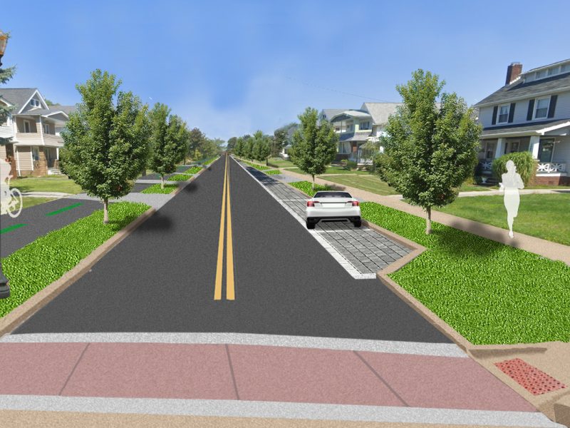
To address problems in the target areas, the study recommends implementing several quick-build, low-cost interventions within the areas to calm traffic and mitigate harm.
This strategy, known as “tactical urbanism,” allows municipalities or individuals to efficiently pilot urbanism projects at a low cost. Then decision makers can observe impact before implementing permanent changes to an area. The city of Cleveland took a similar approach last summer around the city with its speed tables, temporary structures meant to slow drivers while data on the effects of the pilot program were collected.
While large, permanent projects geared toward pedestrian safety have often been slow to come to Cleveland, many small tactical interventions have popped up across the City. Lull gave examples of the tactical urbanism OCI has executed, such as the “pop-up park” at the Jim Mahon Green across Detroit Ave. near West 29th St. It also installed plastic bollards to protect a section of the bike lane on Detroit Ave. between W. 29th and W. 38th in Hingetown. He also cited the example of low-cost, high-impact citizen-built projects that have popped up across Greater Cleveland in areas where residents acted to protect their blocks from traffic danger.
Implementing changes
To fund their planned interventions, OCI is exploring a suite of options, says Lull. They’re seeking funds from various grantmaking organizations, NOACA, the city, ODOT, and any other sources to supplement whatever funds that OCI can allocate from their community fund. With the goal of addressing all nine areas by summer 2023, OCI is moving to gather funds and building materials before proceeding into the project’s final steps. According to Lull, residents should expect change to incrementally as soon as spring, as OCI is timing its interventions to come when streets are being restriped or resurfaced.
Lull estimates the total cost of phase one of the project at about $10,000. The implementation costs of phase two are the biggest question mark. Right now, it’s not clear exactly what the interventions will cost – OCI and 3MPH are still working on estimates – but materials costs could be as low as a few hundred dollars for interventions that only require paint, they say. Other interventions will be as simple as lobbying ODOT or the city to fund improvements or to make necessary changes like retiming stoplights. Some of the costs depend on the success of fundraising, too. “More money would allow us to use higher quality, more sturdy materials potentially, or be more ambitious about the scale of the changes,” Schmitt said.
Lull said that to install their street augmentations, OCI plans to muster a volunteer team composed of residents and members of other interested groups. “Tactical urbanism encourages civic participation, rather than paid contractors,” he said.
Lull is optimistic, and he believes this project is part of a momentum towards an inclusive, pedestrian-friendly Cleveland. “There’s been a lot of improvements coming out of City Hall lately,” said Lull. “In most major cities, we’ve excluded pedestrians and people who use accessibility devices (from public infrastructure). I don’t think that we can ever move fast enough towards making things better, but we are certainly making progress with the new administration.”
Looking ahead, Lull also says that they expect the impact of the study to go further than the nine problem areas in what would be the project’s third phase, now that the City passed its Complete and Green Streets Ordinance in summer 2022. “We’re hoping this study can be used to directly give feedback from the neighborhood to inform the City’s transportation plan as required by the ordinance.”
To learn more about OCI’s specific plans to address the nine target areas, read the full study here. Get involved in Vision Zero here, and reach Ohio City Inc here and 3MPH here.
Editor’s note: This article has been clarified to make clear that the $10,000 cost was only for phase one of the project. In addition, a previous version of this article incorrectly identified the bike lane on Detroit Ave. as a sharrow.
We're celebrating four years of amplifying resident voices from Cleveland's neighborhoods. Will you make a donation to keep our local journalism going?