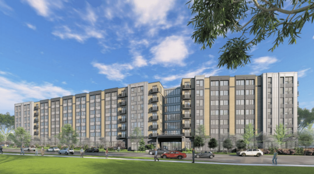
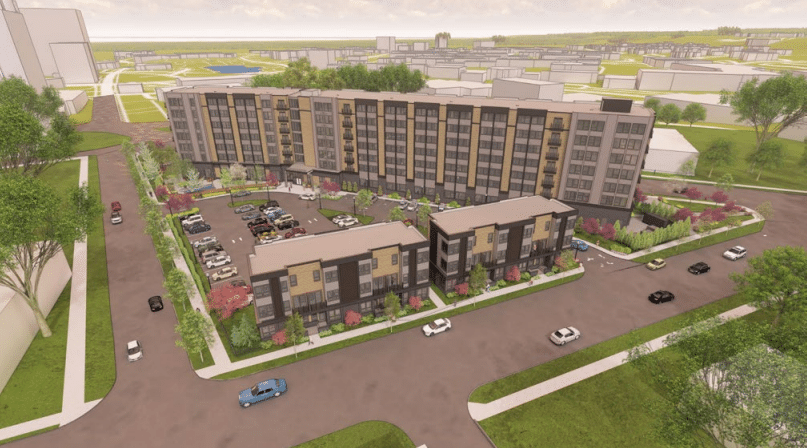
A revised plan for the Stokes West development project at the edge of the Fairfax and University Circle neighborhoods was approved by the Cleveland Planning Commission on Friday, May 19, with a 4-1 vote. The project would bring 255 apartment units and eight townhomes to the triangular lot at the corner of Cedar Ave. and Stokes Blvd. The site was previously home to a parking lot and to historic townhomes that had fallen into disrepair. The developers first proposed tearing down the Cedar Ave. townhomes last year, generating pushback from the planning commission and community members. Now, after multiple iterations, the project is set to break ground.
The revamped project includes numerous tweaks that will make it cheaper to build and operate, a necessity given rising construction and lending costs, the developers said. “Financing is getting more difficult every day, and we run the risk of not being able to build this beautiful project if we’re not able to officially move along and get a shovel in the ground,” Jeff Goldstein, a member of the development team, told the commission. Goldstein said borrowing costs have nearly doubled since the project was first introduced a year ago, while the costs of construction have gone up by around 50%. The other members of the team include ACRE Development, Brent Zimmerman, Rust Belt Development, Geis Companies, LDA Architects, and Donald Bohning and Associates civil engineering.
The new proposed building is larger, has eight townhomes instead of the six that were originally proposed, and includes a handful of extra parking spaces. Two-thirds of the units would be furnished studios aimed at medical professionals and others seeking move-in-ready suites. Rents here would be 13-20% lower than comparable properties in and around University Circle, with a studio renting for $1,395, a one-bedroom for $1,595, and a two-bedroom for $2,495. Rezoning was needed to increase the footprint of the building, which will have 1,990 square feet of co-working space, a 1,510-square-foot games/lounge area, and an 8,900-square-foot outdoor, ground-level amenity deck.
Meeting demand for parking
One unique and controversial aspect of the project is that it only has 35% of the parking spaces required by city code, which mandates a 1:1 parking-to-unit ratio. Goldstein said many residents wouldn’t have cars and minimizing onsite parking was necessary to reduce costs and maintain density. In the past, some city residents have questioned developers’ assertions that renters won’t have cars, arguing that by asking renters to rely on street parking, developers are shifting the burden to the community. Developers and the city, on the other hand, argue that reducing parking allows for more density while encouraging people to live without a car and use other modes of transportation.

In exchange for supporting fewer parking spaces, the city is requiring the developer to come up with a Transit Demand Management strategy. In the presentation, chief zoning administrator Shannan Leonard stated that the developers would provide a 40% public transportation subsidy for residents, if they’re not already eligible for free/discounted transit passes through their employer or another subsidy, and add electric car charging for 10 spaces, to expand to at least 50% over time. The developer is also adding bike repair kits and stations on the premises, ensuring indoor bike parking for at least 150 bikes, and offering a shared bike program.
The city and the developer told the commission that they will study a resident permit parking policy if demand warrants it. Many of the street parking spaces available on Cedar Ave. and adjacent side streets were occupied during a daytime visit to the development last week. However, Elise Yablonsky, vice president of community planning for University Circle Inc., which owns the property and has entered into a ground lease with the developer, praised Stokes West at the meeting, saying it’s exactly the kind of transit-oriented development that the city needs.
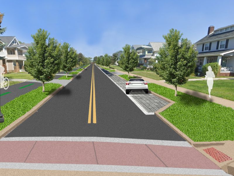
Yablonsky told The Land that UCI, the city, and the developer are currently studying enhancements to make the area more pedestrian, bike, and transit friendly. These include closure of the slip lane in the southeast corner of the Stokes Blvd. and Carnegie Ave. intersection, a road diet along Stokes Blvd. to reduce the number of travel lanes and repurpose the excess space for other uses (including parking), and a bike facility along Stokes Blvd. as a connection between the Lake-to-Lakes Trail at Ambler Park and bikes lanes on Euclid Ave.
“The Stokes West development, through its focus as a transit-oriented development, has been a catalyst for discussing implementation of these improvements with the city of Cleveland,” Yablonsky said in an email. “A traffic impact study completed by the development team in December 2022 confirmed that the above recommendations are viable based on current and future projected traffic counts. The potential closure of the slip lane is currently under review by the city for a temporary pilot installation. UCI and the city are also discussing a future feasibility study of a bike facility on Stokes. In the short term, a road diet is intended to be implemented between Carnegie Ave. and Cedar Ave. through the provision of on-street parking along the development’s frontage. Long-term options for a road diet could be further considered by a bike facility feasibility study.”
“Altogether, these improvements would facilitate better mobility for an area of University Circle that can currently be difficult and uncomfortable to travel as a non-car user,” Yablonsky said. “This is especially critical for this area of the Stokes Corridor given its proximity to existing bike infrastructure (Lake-to-Lakes Trail/Harrison Dillard Bikeway and Euclid Avenue bike lanes) and key transit routes (Health Line, Red Line rapid transit, and several other bus routes).”
Making the area less car-oriented
Several planning commission members concurred that more work is needed to make the area friendlier to pedestrians, cyclists, and transit users. Commission member and Ward 17 council member Charles Slife said that crossing Stokes and Cedar in that area was dangerous and comparable to playing a real-life game of Frogger, and commission member August Fluker agreed that the area can be dangerous. Yablonsky and the developer pledged to work with the city and the developer to improve crosswalks and make the area more pedestrian, bike, and transit-friendly.
In past meetings, planning commission members have raised questions about racial equity, saying that much of the area’s rich African American history has already been lost to demolition. Fluker, a retired architect who lives in Fairfax, withheld his support but said the developers had improved their outreach. “I commend you guys for bringing in more diverse voices to this process at the urging of this commission,” he said. “Hopefully there’s a lesson to be learned here, that when designing in black and brown communities, you need to lean in, you need to be considerate, and you need to be transparent. As you develop around the city, I hope you take that lens with you.”
You can watch the recording of the May 19 planning commission meeting here. To send questions, comments, and feedback to the Cleveland City Planning Commission, email cityplanning@clevelandohio.gov or call 216-664-2210.
Keep our local journalism accessible to all
Reader support is crucial as we continue to shed light on underreported neighborhoods in Cleveland. Will you become a monthly member to help us continue to produce news by, for, and with the community?
P.S. Did you like this story? Take our reader survey!