“The soil is pretty good and the water is extraordinary good and plenty. The timber is Beach, Elm, Ash, Maple, Walnut, Oak, Chestnut, Whitewood, Butternut, Black Walnut, Bass and some Hemlock. There are some grape vines at this place, loaded with their fruit and that extraordinary good kind.” – Amzi Atwater, 1796
The Cleveland of 1796
Most Clevelanders would be surprised by this description of the Cuyahoga’s banks, but when Moses Cleaveland first arrived to survey a capital city for the Connecticut Land Company, this is what he saw. Cleaveland – who gave the city its alternatively spelled name – reached the river’s mouth on July 22, 1796, and then proceeded up the river to what is now First Settler’s Park. Before that date, the land was sparsely populated by groups of Native Americans, traders and missionaries, so it was not the “dense, dark wilderness, untrodden by the footsteps of civilization,” that the “Cleveland Leader and Herald” imagined in 1888. Still, it was wild and untamed.
Unlike the landscape we see today, when General Cleaveland arrived, the Cuyahoga River and its surroundings were populated by a diverse array of plants and animals. In his field notes, John Milton Holley, 18-years-old and perhaps the youngest of the surveyors, wrote, “The day before we started from Cuyahoga we discovered a bear swimming across the Cuyahoga – Porter and myself jumped into a canoe and paddled after him, while another man with a gun went up the shore after him – but there was such a noise a hallooing that the bear swam back and escaped.” Shortly after, Holley wrote that another surveyor named “Munson caught a rattlesnake which we boiled to eat.”
ODNR’s Efforts to Envision Ohio As It Was Before Settlement
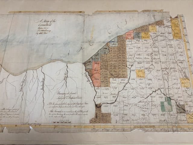
While it is difficult to imagine this diversity of life that the men encountered, that is the aim of a project run by the Ohio Department of Natural Resources’ Division of Natural Areas and Preserves (DNAP). Led by Rick Gardner, Ohio’s chief botanist, project staff and volunteers are scouring old maps and surveying reports so that they can determine what types of plants grew in Ohio prior to its settlement. It is painstaking work that combines archival research with current knowledge of plant species and their growing habits – a truly multidisciplinary task. Jennifer Hillmer, a retired invasive plant coordinator at Cleveland Metroparks and a volunteer with the project, spoke with the Land about her research at the Western Reserve Historical Society and the way it is being integrated into the larger project. She said that DNAP has, “really great plant ecologists, and so they can look at the historical record to know what were the major trees that were listed, and they can extrapolate from that and from our existing knowledge of the present day to what the plant communities were like.”

Once the data collection is complete, researchers will finalize a map that records which plant species grew in precise areas of Ohio around the time that Moses Cleaveland arrived. Hillmer said that, apart from the excitement that such a project generates for plant and map lovers, it will provide researchers and environmentalists with a deeper understanding of what might grow well in the Ohio of the future and of how plant species have migrated over time.
Hillmer also hopes the project will garner interest in Cleveland’s natural environment. She said that if the project helps to increase “the number of people who think that’s really interesting by 5% or 10% that’s quite a lot more people who care about our natural areas, and who care about our parks or our preserved areas. Or who care about the connections that we have with where we live.”
A Land of Dunes and Forests
Hillmer’s research has given her fascinating insight into what it might have been like for Moses Cleaveland’s party to land on our shores: “It was probably mostly sand dunes, you know, with scrubby vegetation and, not too far into that, you would get into forest.” Apart from areas that had experienced a tornado or burn, it is likely that the variation in tree growth was more variable than it is today.
Hillmer explained, “It’s very hard to picture our forests versus the 18th century forests. A lot of our forests, you look and most of the trees are pretty much close to the same size. You don’t see a lot of real difference in the size of the trunks and the height because so much of our forests were cut down once – or more than once – cleared for farming or timber, so they’re all kind of growing at the same time. Whereas, what we now call an old growth forest or mature forest would have had … a much wider diversity of tree sizes and heights, and what was in the under story … and then some trees aren’t in our forest at all. Like chestnuts are gone and they were an enormous component of the forest and so we’re trying to imagine what forests looked like without one of the major species that was in it.”
Cleaveland’s Landing and Survey
It was onto this unrecognizable land that Moses Cleaveland and his party disembarked as they set out on a months’ long project of measuring, mapping, recording and surviving. It was the last of these tasks which required the most effort, as the men faced dysentery, mosquitos, hunger and storms. At times, the ground itself proved treacherous, as cranberry bogs and swamps were, according to Atwater, “so mighty that it was dangerous to attempt and difficult to perform a passage through either by man or beast.” Hillmer explained this danger based on her own experience working in the field: “They’re hard to deal with, because you’re walking on solid ground and then you’re on spongy ground and then you break through. You could be up to your chest, you know, you just go right through. And imagine you’re dragging this heavy chain, and you have to go in that straight line. You don’t get to go around, and they’re fully clothed.”
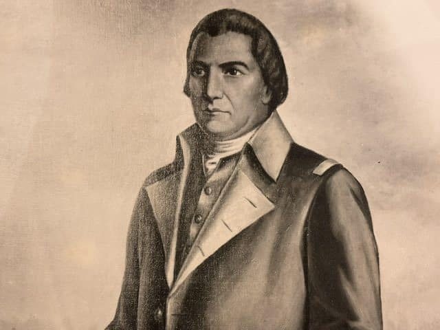
From mid-summer through part of autumn, the men set out each day with surveying tools to measure and divide the land that would become Cleveland into distributable plots. According to the Case Western Reserve Encyclopedia of Cleveland History, Gen. Cleaveland, a wealthy lawyer and Revolutionary war veteran, chose to survey a flat area above the Cuyahoga saying, “I believe, as now informed, the Cuyahoga will be the place. It must command the greatest communication either by land or water of any River on the purchase or in any ceded lands from the head of the Mohawk to the Western extent or I am no prophet.”
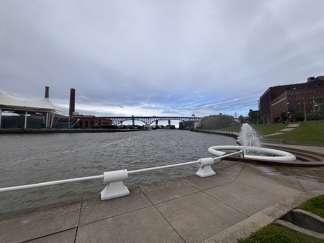
Influenced by Cleaveland’s Connecticut upbringing, the men laid out a 10-acre, New England-style town square (today Public Square), which was dissected by Ontario and Superior streets. One end of Superior Street descended to a landing place on the Cuyahoga River where the men anticipated lake traffic would come and go.
The work was difficult and there were few familiar comforts. As Millner said, “I worked in natural areas management, so I’ve been in swamps like these, the trees are smaller now (because everything got cut down), but I’ve been in these kinds of areas, and I know how hard it can be for a single day. I get to go home, I mean, I have left and right shoes and a car, and I can go home, and I can get clean and dry, and I can take aspirin, and these guys had none of that at all.”
The Rest of the Story
According to Atwater, when the survey was completed in October, 1896, three people remained behind to winter in the settlement’s first log cabins: Job P. Stiles, Talitha Ami Stiles and Joseph London. London decided to return to New England at some point in the late fall or winter, which the 1896 book, “Tales from Ohio History for Home and School,” humorously suggested happened when he realized that “two are a company, three a crowd.”
While some of the surveyors eventually returned to live in Cleveland and the surrounding areas, Moses Cleaveland never did. His last glimpses of the city that would one day bear his name barely hinted at the future; for him, Cleveland remained an untamed land of dunes, swamp and forest.
Cleaveland, who Atwater described as “a short thick set man, with a broad face, dark complexion, very coarse features and slovenly dress and very vulgar in his conversation and manners,” would spend the remainder of his life in Connecticut, raising a child who suffered from a congenital disease. Despite some outstanding debt, his will, which included a beaver hat, epaulettes, a silver headed sword, a musket, classic works by Voltaire and Benjamin Franklin, and farm animals, reflects the wealth and prosperity that he enjoyed during his lifetime. He also left a reputation of being an honorable, respectable man – a description vastly different from the one offered by Atwater.
While less is known about what became of the other men in Cleaveland’s surveying party, what is known about them is equally interesting. Thanks to Atwater’s colorful writings and reflections, it is easy to imagine this eclectic group of men who were forced into one another’s company by circumstance. Some, like surveyor Richard Spafford, were serious, deliberate and methodical. Others, like surveyor M. Harren Esquire, were described as “rather more ready to tell a good story than to persevere in the woods.” Harren’s foil, Mr. Porter, the principal surveyor, was a visible outdoorsman. In fact, Atwater said, “We might see by his appearance he was capable and determined to go through thick and thin in the business in which he was engaged.” Porter was missing his thumb due to its being “lost by the bursting of a gun.” Another member of the party, Mr. Pease, who drew one of the two first maps of Cleveland, was described by Atwater as not very tall, but having “black piercing eyes.” Atwater also noted his high level of energy and his thoughtful appearance.
These literary glimpses of the people who began Cleveland stand in stark contrast to the unimaginable landscape that they sought to subdue. In many ways, the surveyors were like us and, yet, the land they trod was nothing like the Cleveland we know today. As Jennifer Hillmer said, “If you took an indigenous person who lived in this area his whole life, there would be nothing recognizable at all.”
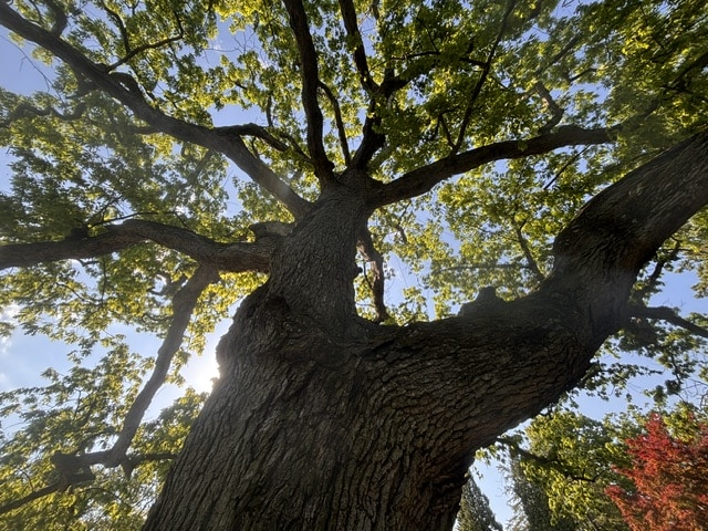
The Moses Cleaveland Trees
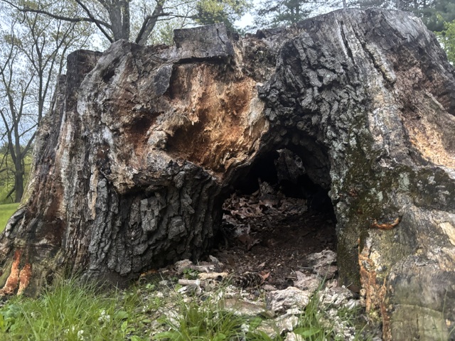
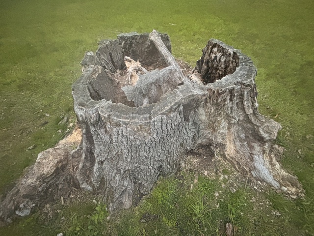
However, even after 230 years, a few living things remain to bridge this seemingly impassible gap between the familiar and the foreign: the Moses Cleaveland Trees. On the 150th anniversary of Moses Cleaveland’s arrival at the mouth of the Cuyahoga, Arthur B. Williams decided to label 150 trees that were determined to be native species and at least 150 years old. Williams marked these first “witness trees,” which represented 23 distinct species, with metal labels.
Eventually, the project became a focus of the Early Settlers Association of the Western Reserve. Using tree circumferences and working with residents and arborists, additional Moses Cleaveland Trees – and their photographs – were identified over time. During the most recent survey of the trees, the Early Settlers Association began the process of digitally mapping them so that interested members of the community can find them, even though most of their labels are long gone. Lakeview Cemetery is currently home to the largest number of Moses Cleaveland Trees, in part because of the deliberate care provided to plants growing on the cemetery grounds. Even within the cemetery, however, the diversity of tree types has dwindled. Almost all remaining Moses Cleaveland Trees are White Oak due to their strength and resistance to many diseases.
This small sampling of what once was will not last forever. The Early Settlers Organization notes, “as they are living organisms, all will eventually die.” While we have them, though, the Moses Cleaveland trees are likely the only living connections we have to pre-settlement Cleveland.
Today, a person can stand a short distance from one of the Moses Cleaveland Trees growing beside Lower Shaker Lake and look towards the city skyline five miles away, knowing that there is nothing between the two points that remains unchanged from 1796. It is a disorienting and sobering realization. Yet, while we have them, the Moses Cleaveland Trees offer us a portal to the Cleveland that greeted Moses Cleaveland’s surveying party in 1976. They are a piece of history that we can see, touch, smell, enjoy and protect. They ground us in history and root us to the places where we work, play and live, reminding us of where we have been, challenging who we are, and beckoning us towards what we might one day become.
We're celebrating four years of amplifying resident voices from Cleveland's neighborhoods. Will you make a donation to keep our local journalism going?